Gavroche
Well-Known Member
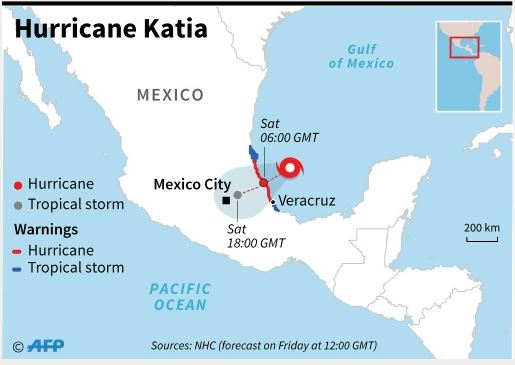
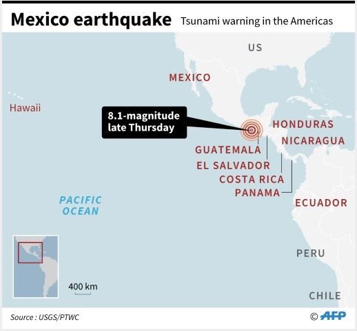
Guadeloupe, Saint-Barthélemy et autres ... and Cuba ?...

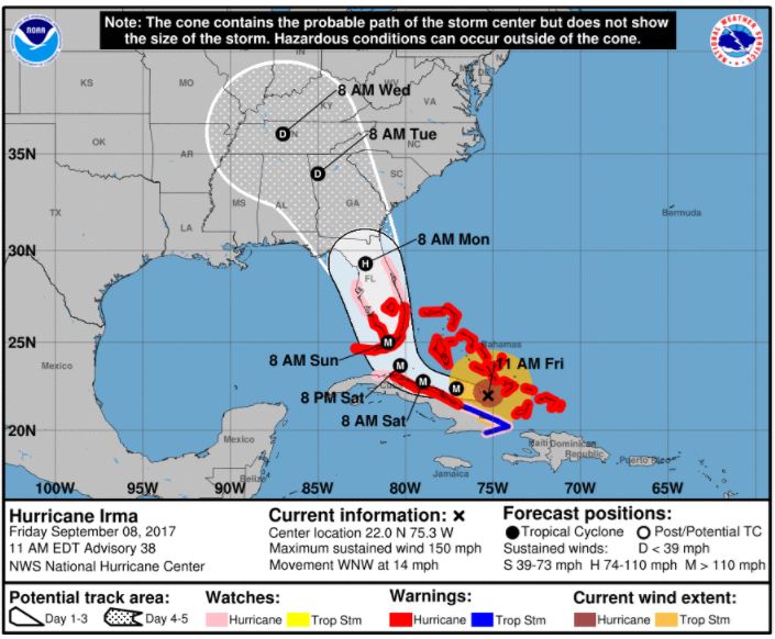

well. we made the desicision to '' BUG-OUT''...ill be taking a couple tents,, canned food,, water,,,, batteries,,,, depending on what it's doing saturday will decide if and when i leave... and then depending on its direction will determine where i go.. and come back.. proablly the following thursday... gonna take the fishing equipment.. i may go to ALABAMA ... for a couple days... hang at a state park. and do some fishing.
and proablly come back to my place really hit hard... i dont think anyone is safe. if it comes right up the middle of the state,!!!!! the interstate I-75 north bound lane is gridlocked right now,,,, it's about 1/4 mile from the house,,, i hear tires blow out constantlly,
but when i leave.. i'll be using the backroads. till i clear the bottleneck of escappees from florida,
...